
Articles | Volume 33, issue 3
https://doi.org/10.5194/npg-33-489-2026
© Author(s) 2026. This work is distributed under
the Creative Commons Attribution 4.0 License.
the Creative Commons Attribution 4.0 License.
https://doi.org/10.5194/npg-33-489-2026
© Author(s) 2026. This work is distributed under
the Creative Commons Attribution 4.0 License.
the Creative Commons Attribution 4.0 License.
Research article
| 
21 Sep 2026
Research article |
| 21 Sep 2026
| 21 Sep 2026
Data assimilation of coherent structures in parametric and gridded spaces: an idealized ocean eddy study
Solène Dealbera
CORRESPONDING AUTHOR

IMT Atlantique, Lab-STICC, UMR 6285, 29238, CNRS, Brest, France
ODYSSEY Team-Project, INRIA Ifremer IMT-Atl., 35042, CNRS, Brest, France
Stéphane Raynaud
Shom, 29200 Brest, France
Carlos Granero Belinchon
IMT Atlantique, Lab-STICC, UMR 6285, 29238, CNRS, Brest, France
ODYSSEY Team-Project, INRIA Ifremer IMT-Atl., 35042, CNRS, Brest, France
Brahim Boussidi
LEGOS Observatoire Midi-Pyrénées, 14 avenue Édouard Belin, 31400 Toulouse, France
Clément Le Goff
LEGOS Observatoire Midi-Pyrénées, 14 avenue Édouard Belin, 31400 Toulouse, France
Pierre Tandeo
IMT Atlantique, Lab-STICC, UMR 6285, 29238, CNRS, Brest, France
ODYSSEY Team-Project, INRIA Ifremer IMT-Atl., 35042, CNRS, Brest, France
Related authors

Damien Sous, Marc Pezerat, Solène Dealbera, Héloïse Michaud, and Denis Morichon
Ocean Sci., 21, 3165–3178, https://doi.org/10.5194/os-21-3165-2025, https://doi.org/10.5194/os-21-3165-2025, 2025
Short summary
Short summary
The circulation of nearshore water is of primary importance for the health of coastal ecosystems and the coastal hazards, such as erosion. The present study focuses on the role played by bottom friction, which is particularly important in rocky or coral reef areas. Using field observations and numerical simulations, we show that the waves are able to increase the bottom friction and therefore affect the whole circulation and water level dynamics.
Erwan Le Roux, Pierre Tandeo, Carlos Granero Belinchon, Melika Baklouti, Julien Le Sommer, Florence Sevault, Samuel Somot, Antoine Doury, and Mahmoud Al Najar
EGUsphere, https://doi.org/10.5194/egusphere-2026-1991, https://doi.org/10.5194/egusphere-2026-1991, 2026
Short summary
Short summary
Projected impacts of climate change are assessed with impact models driven by climate projections. However, impact models can have a high computational cost. Here, we design statistical emulators of impact models based on automatic equation discovery. To our knowledge, this approach is a promising innovation that could pave the way to develop simple and interpretable emulators for various climate impact studies, but also to validate existing knowledge and to understand novel links.
Amélie Simon, Pierre Tandeo, Florian Sévellec, and Camille Lique
The Cryosphere, 19, 6639–6658, https://doi.org/10.5194/tc-19-6639-2025, https://doi.org/10.5194/tc-19-6639-2025, 2025
Short summary
Short summary
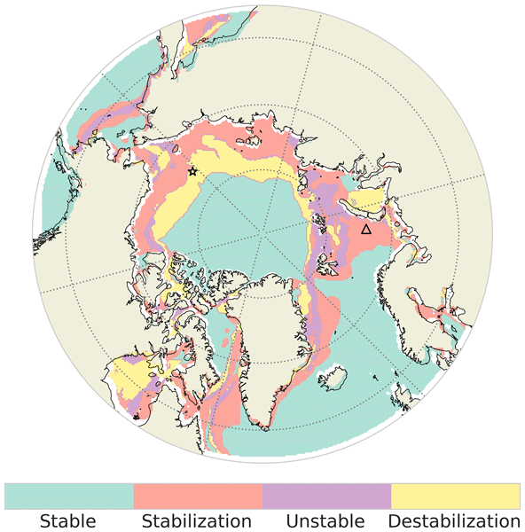
Through a machine learning technique based on seasonal cycles of sea-ice concentration from satellite data over the last 4 decades, our research shows that four regions are sufficient to best regionalize the Arctic. These regions are mainly organized into latitudinal bands and evolve in time and space. The descriptor proposed to monitor Arctic sea-ice changes is the probability to belong to each region. The probability to belong to the permanent sea-ice regions has decreased by 3.1 % per decade.
Damien Sous, Marc Pezerat, Solène Dealbera, Héloïse Michaud, and Denis Morichon
Ocean Sci., 21, 3165–3178, https://doi.org/10.5194/os-21-3165-2025, https://doi.org/10.5194/os-21-3165-2025, 2025
Short summary
Short summary
The circulation of nearshore water is of primary importance for the health of coastal ecosystems and the coastal hazards, such as erosion. The present study focuses on the role played by bottom friction, which is particularly important in rocky or coral reef areas. Using field observations and numerical simulations, we show that the waves are able to increase the bottom friction and therefore affect the whole circulation and water level dynamics.
Paul Platzer, Pierre Ailliot, Bertrand Chapron, and Pierre Tandeo
Clim. Past, 20, 2267–2286, https://doi.org/10.5194/cp-20-2267-2024, https://doi.org/10.5194/cp-20-2267-2024, 2024
Short summary
Short summary
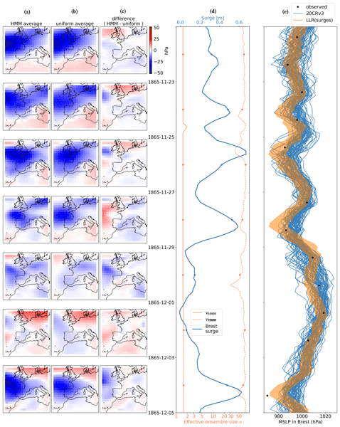
Old observations are necessary to understand the atmosphere. When direct observations are not available, one can use indirect observations, such as tide gauges, which measure the sea level in port cities. The sea level rises when local air pressure decreases and when wind pushes water towards the coast. Several centuries-long tide gauge records are available. We show that these can be complementary to direct pressure observations for studying storms and anticyclones in the 19th century.
Pierre Le Bras, Florian Sévellec, Pierre Tandeo, Juan Ruiz, and Pierre Ailliot
Nonlin. Processes Geophys., 31, 303–317, https://doi.org/10.5194/npg-31-303-2024, https://doi.org/10.5194/npg-31-303-2024, 2024
Short summary
Short summary
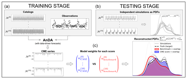
The goal of this paper is to weight several dynamic models in order to improve the representativeness of a system. It is illustrated using a set of versions of an idealized model describing the Atlantic Meridional Overturning Circulation. The low-cost method is based on data-driven forecasts. It enables model performance to be evaluated on their dynamics. Taking into account both model performance and codependency, the derived weights outperform benchmarks in reconstructing a model distribution.
Pierre Tandeo, Pierre Ailliot, and Florian Sévellec
Nonlin. Processes Geophys., 30, 129–137, https://doi.org/10.5194/npg-30-129-2023, https://doi.org/10.5194/npg-30-129-2023, 2023
Short summary
Short summary
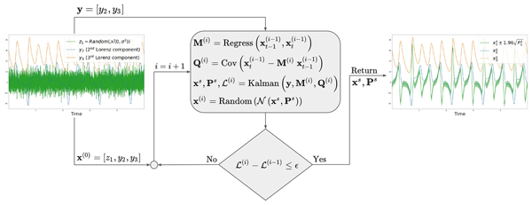
The goal of this paper is to obtain probabilistic predictions of a partially observed dynamical system without knowing the model equations. It is illustrated using the three-dimensional Lorenz system, where only two components are observed. The proposed data-driven procedure is low-cost, is easy to implement, uses linear and Gaussian assumptions and requires only a small amount of data. It is based on an iterative linear Kalman smoother with a state augmentation.
Robin Marcille, Maxime Thiébaut, Pierre Tandeo, and Jean-François Filipot
Wind Energ. Sci., 8, 771–786, https://doi.org/10.5194/wes-8-771-2023, https://doi.org/10.5194/wes-8-771-2023, 2023
Short summary
Short summary
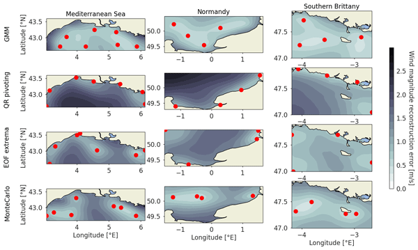
A novel data-driven method is proposed to design an optimal sensor network for the reconstruction of offshore wind resources. Based on unsupervised learning of numerical weather prediction wind data, it provides a simple yet efficient method for the siting of sensors, outperforming state-of-the-art methods for this application. It is applied in the main French offshore wind energy development areas to provide guidelines for the deployment of floating lidars for wind resource assessment.
Juan Ruiz, Pierre Ailliot, Thi Tuyet Trang Chau, Pierre Le Bras, Valérie Monbet, Florian Sévellec, and Pierre Tandeo
Geosci. Model Dev., 15, 7203–7220, https://doi.org/10.5194/gmd-15-7203-2022, https://doi.org/10.5194/gmd-15-7203-2022, 2022
Short summary
Short summary
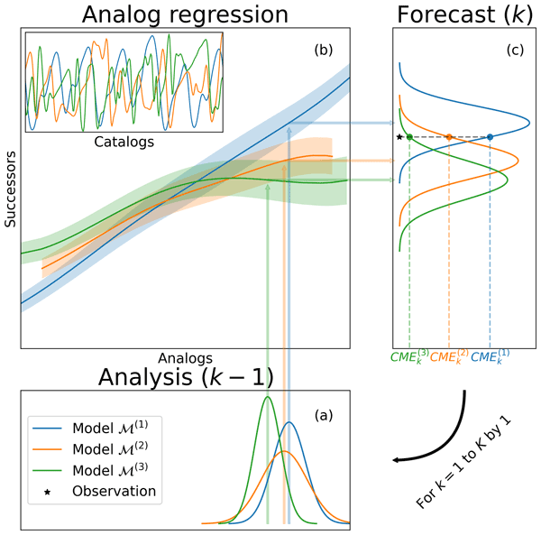
We present a new approach to validate numerical simulations of the current climate. The method can take advantage of existing climate simulations produced by different centers combining an analog forecasting approach with data assimilation to quantify how well a particular model reproduces a sequence of observed values. The method can be applied with different observations types and is implemented locally in space and time significantly reducing the associated computational cost.
Etienne Pauthenet, Loïc Bachelot, Kevin Balem, Guillaume Maze, Anne-Marie Tréguier, Fabien Roquet, Ronan Fablet, and Pierre Tandeo
Ocean Sci., 18, 1221–1244, https://doi.org/10.5194/os-18-1221-2022, https://doi.org/10.5194/os-18-1221-2022, 2022
Short summary
Short summary
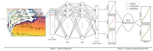
Temperature and salinity profiles are essential for studying the ocean’s stratification, but there are not enough of these data. Satellites are able to measure daily maps of the surface ocean. We train a machine to learn the link between the satellite data and the profiles in the Gulf Stream region. We can then use this link to predict profiles at the high resolution of the satellite maps. Our prediction is fast to compute and allows us to get profiles at any locations only from surface data.
Cited articles
Alvera-Azcárate, A., Van der Zande, D., Barth, A., Dille, A., Massant, J., and Beckers, J.-M.: Generation of super-resolution gap-free ocean colour satellite products using data-interpolating empirical orthogonal functions (DINEOF), Ocean Sci., 21, 787–805, https://doi.org/10.5194/os-21-787-2025, 2025. a
Aydoğdu, A., Carrassi, A., Guider, C. T., Jones, C. K. R. T., and Rampal, P.: Data assimilation using adaptive, non-conservative, moving mesh models, Nonlin. Processes Geophys., 26, 175–193, https://doi.org/10.5194/npg-26-175-2019, 2019. a, b
Beezley, J. D. and Mandel, J.: Morphing ensemble Kalman filters, Tellus, 60, 131–140, https://doi.org/10.1111/j.1600-0870.2007.00275.x, 2008. a
Carrassi, A., Bocquet, M., Bertino, L., and Evensen, G.: Data assimilation in the geosciences: an overview of methods, issues, and perspectives, WIREs Clim. Change, 9, e535, https://doi.org/10.1002/wcc.535, 2018. a
Casella, G. and Robert, C. P.: Rao-Blackwellisation of sampling schemes, Biometrika, 83, 81–94, https://doi.org/10.1093/biomet/83.1.81, 1996. a
Chelton, D. B., Schlax, M. G., and Samelson, R. M.: Global observations of nonlinear mesoscale eddies, Prog. Oceanogr., 91, 167–216, https://doi.org/10.1016/j.pocean.2011.01.002, 2011. a
Chen, R. and Liu, J. S.: Mixture Kalman filters, J. Roy. Stat. Soc. B Met., 62, 493–508, 2000. a
Chen, Y. and Snyder, C.: Assimilating vortex position with an ensemble Kalman filter, Mon. Weather Rev., 135, 1828–1845, https://doi.org/10.1175/MWR3351.1, 2007. a, b
Coifman, R. R. and Lafon, S.: Diffusion maps, Appl. Comput. Harmon. A. 21, 5–30, https://doi.org/10.1016/j.acha.2006.04.006, 2006. a
Evensen, G.: The ensemble Kalman filter: theoretical formulation and practical implementation, Ocean Dynam., 53, 343–367, https://doi.org/10.1007/s10236-003-0036-9, 2003. a
Feyeux, N., Vidard, A., and Nodet, M.: Optimal transport for variational data assimilation, Nonlin. Processes Geophys., 25, 55–66, https://doi.org/10.5194/npg-25-55-2018, 2018. a, b
Hannachi, A., Jolliffe, I. T., and Stephenson, D. B.: Empirical orthogonal functions and related techniques in atmospheric science: a review, Int. J. Climatol., 27, 1119–1152, https://doi.org/10.1002/joc.1499, 2007. a
Hirt, C. W., Amsden, A. A., and Cook, J. L.: An arbitrary Lagrangian-Eulerian computing method for all flow speeds, J. Comput. Phys., 14, 227–253, https://doi.org/10.1016/0021-9991(74)90051-5, 1974. a
Jazwinski, A. H.: Stochastic Processes and Filtering Theory, ISBN 78-0-12-381550-7, 1970. a
Kunii, M.: Assimilation of tropical cyclone track and wind radius data with an ensemble Kalman filter, Weather Forecast., 30, 1050–1063, https://doi.org/10.1175/WAF-D-14-00088.1, 2015. a
Li, F. and Marzouk, Y.: Diffusion map particle systems for generative modeling, Foundations of Data Science, 7, 814–837, https://doi.org/10.3934/fods.2024054, 2025. a
Maclean, J., Santitissadeekorn, N., and Jones, C. K.: A coherent structure approach for parameter estimation in Lagrangian data assimilation, Physica D, 360, 36–45, https://doi.org/10.1016/j.physd.2017.08.007, 2017. a
Nino Ruiz, E. D., Sandu, A., and Anderson, J.: An efficient implementation of the ensemble Kalman filter based on an iterative Sherman-Morrison formula, Stat. Comput., 25, 561–577, https://doi.org/10.1007/s11222-014-9454-4, 2015. a
Parno, M., Moselhy, T., and Marzouk, Y.: A multiscale strategy for Bayesian inference using transport maps, SIAM/ASA Journal on Uncertainty Quantification, 4, 1160–1190, https://doi.org/10.1137/15M1032478, 2016. a
Poterjoy, J.: A localized particle filter for high-dimensional nonlinear systems, Mon. Weather Rev., 144, 59–76, https://doi.org/10.1175/MWR-D-15-0163.1, 2016. a
Ravela, S., Emanuel, K., and McLaughlin, D.: Data assimilation by field alignment, Physica D, 230, 127–145, https://doi.org/10.1016/j.physd.2006.09.035, 2007. a
Rosenthal, W. S., Venkataramani, S., Restrepo, J. M., and Mariano, A.: Displacement data assimilation, J. Comput. Phys., 330, 594–614, https://doi.org/10.1016/j.jcp.2016.10.025, 2017. a
Sampson, C., Carrassi, A., Aydøğdu, A., and Jones, C. K. R. T.: Ensemble Kalman filter for nonconservative moving mesh solvers with a joint physics and mesh location update, Q. J. Roy. Meteor. Soc., 147, 1539–1561, https://doi.org/10.1002/qj.3980, 2021. a
Šmídl, V. and Hofman, R.: Marginalized particle filtering framework for tuning of ensemble filters, Mon. Weather Rev., 139, 3589–3599, https://doi.org/10.1175/2011MWR3586.1, 2011. a, b
Srivastava, A., Kang, W., and Tartakovsky, D. M.: Feature-informed data assimilation, J. Comput. Phys., 494, 112499, https://doi.org/10.1016/j.jcp.2023.112499, 2023. a
van Leeuwen, P. J.: Nonlinear data assimilation in geosciences: an extremely efficient particle filter, Q. J. Roy. Meteor. Soc., 136, 1991–1999, https://doi.org/10.1002/qj.699, 2010. a
Wu, C.-C., Lien, G.-Y., Chen, J.-H., and Zhang, F.: Assimilation of tropical cyclone track and structure based on the ensemble Kalman filter (EnKF), J. Atmos. Sci., 67, 3806–3822, https://doi.org/10.1175/2010JAS3444.1, 2010. a
Zhen, Y., Resseguier, V., and Chapron, B.: Alignment of geophysical fields: a differential geometry perspective, Physica D, 483, 134997, https://doi.org/10.1016/j.physd.2025.134997, 2025. a
Short summary
The goal of data assimilation in geoscience is to merge information from models and observations. In the presence of structures such as ocean eddies, classic assimilation schemes fail to merge those two sources, resulting in position and shape errors. Here, we propose a new scheme which assimilates only the parameters describing a simplified eddy structure. Comparison with classic schemes shows that our approach preserves the eddy parameters and may reduce the computational cost.
The goal of data assimilation in geoscience is to merge information from models and...


